AirPoint™
Your Response, Elevated
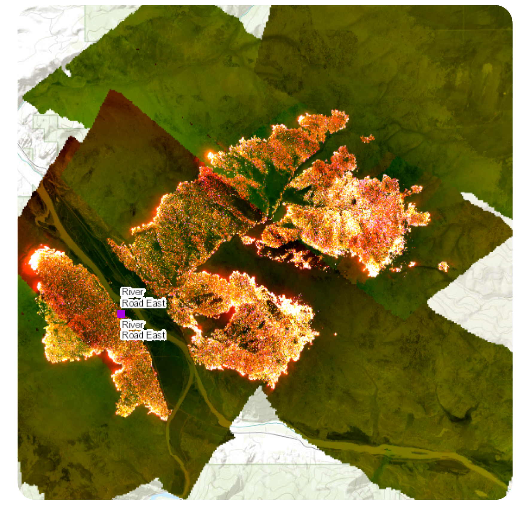
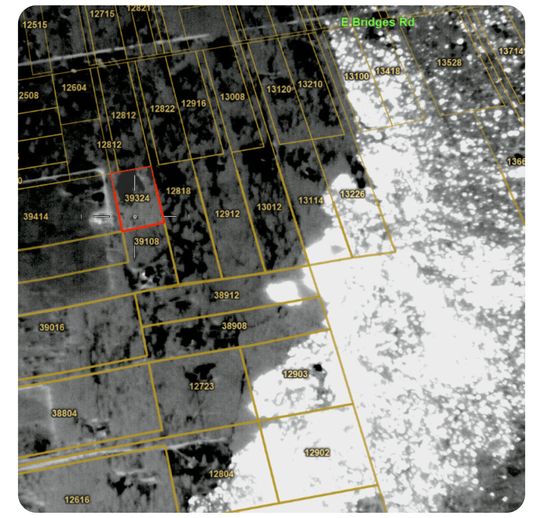
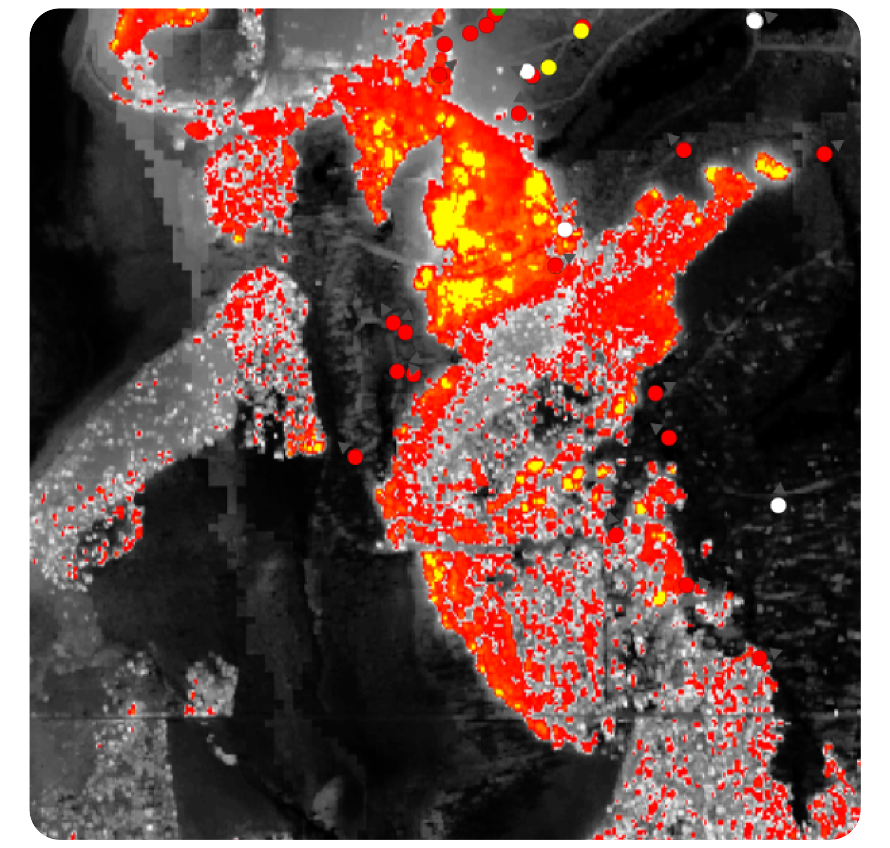
AirPoint delivers high-resolution aerial imagery integration and capability, providing essential visual intelligence for incident management across diverse environments.
- Fire spread
- Evacuation routes
- Resource placements
- Emergencies
- Accidents
- Natural disasters
- Environmental changes
- Ecological disasters
- Severe weather events
- Public incidents
Aerial advantage in crisis response
- Enables immediate access to aerial views, which is critical for the quick deployment of resources during a crisis.
- Adjust your tactics on-the-fly as conditions evolve.
Operational Risk Management
- Get detailed aerial data that helps identify potential risks and unsafe areas before they pose a threat.
- Enhance visibility of critical areas with high-resolution imagery of inaccessible areas.
Seamless Systems Integration
- Easily integrates enhancing data coherence and operational continuity.
- Real-time data sharing between various agencies.
Key Features
• Real-Time Visual Intelligence
Access updated aerial imagery to make informed decisions with crucial visuals of the operational area.

• Situational Awareness
Gain a bird's-eye view of the incident's size, progression, and potential threats to adapt strategies and allocate resources effectively.
• Resource Deployment
Pinpoint exact locations for critical resource deployment, optimizing personnel and equipment use while reducing response times.

• Strategy Evaluation
Continuously assess and adjust tactics in real-time to enhance the effectiveness of suppression efforts.
• Scalability
Suitable for incidents of varying sizes and complexities, thanks to its ability to scale and cover larger areas.

• Improved Safety
Identify hazardous conditions and ensure the safety of responders and the public by highlighting changing conditions and potential blockages.
Funding
Have limited funding? We may be able to help here >
Resources
AirPoint™
Watch a Short Product Video
Sometimes it is easier to see it in action. Check out this short video.
WatchSee How Others Find Success
Many agencies are having success with AirPoint. Explore the reasons why.
ViewDownload a One-Page Summary
Take this document with you and show AirPoint to your team.
DownloadExplore Our Related Articles
Stay up to date on the latest and greatest in the aerial imagery space.
Read