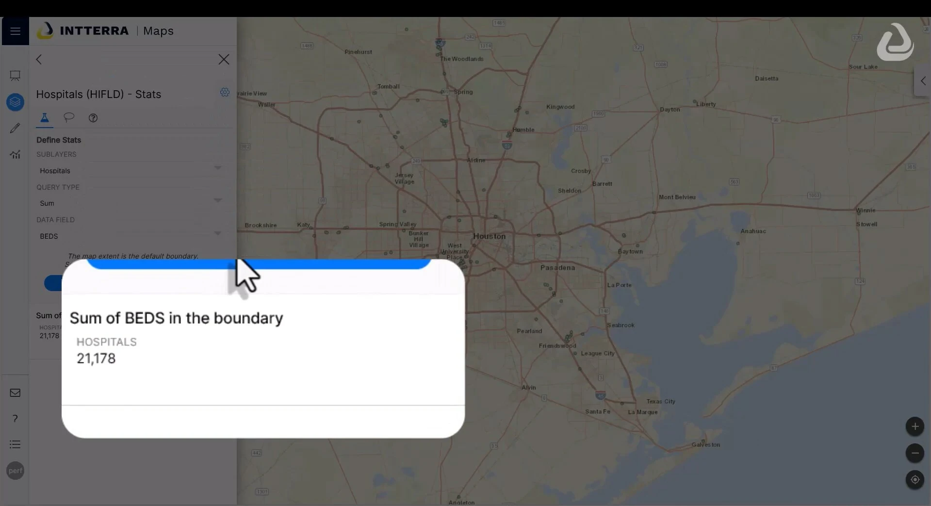
Intterra has announced the expansion of their Stats tool across all map layers in their core products, enhancing the ability of Command Staff to understand environments and make informed real-time decisions. This expansion allows users to quickly access vital information like available hospital beds in an area, facilitating the creation of effective mitigation plans and response strategies in emergency situations.
The enhanced Stats tool enables first responders and command staff to select from various data layers, such as population count, building count, property value, preplan mapping, and location demographics, to gather critical information for operational planning, emergency evacuation, and incident summaries. Users can utilize predefined polygons or create custom shapes to target specific locations, thus improving active intelligence gathering. According to Adam Gotlieb, Chief Product Officer, and Mike Soldan, CEO at Intterra, this update, driven by customer feedback, exemplifies Intterra’s commitment to providing comprehensive, quick-access community data tools for emergency planning, response, and recovery.
Read the full press release